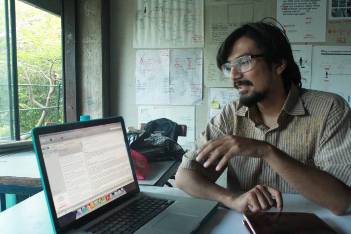
Concept video for PoliCiti. An application designed to run on mobile phones as well as public devices (ATMs, e-seva kendra, etc) based on open data that makes the police complaint filing process more citizen-centric, and gives the citizens evidence to demand a better policing system in India.
Category Archives: Design Development
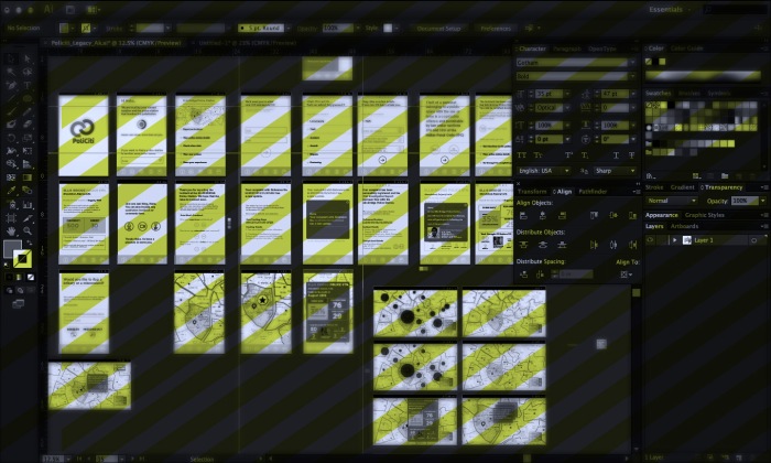
PoliCiti UI Glimpse
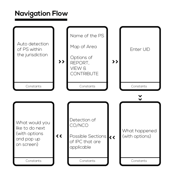
The Navigation Flow
The approach to start building a possible solution was governed by an important factor:
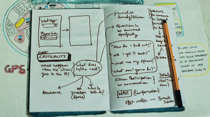
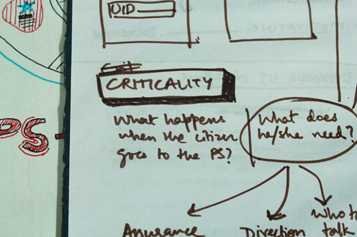
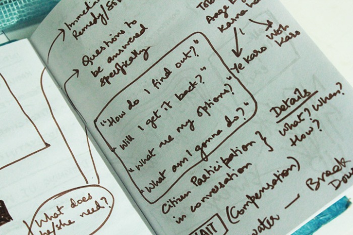
“What would a citizen ideally need at the given point / given time. ”
Keeping that as a constant, our next step was to see how the navigation could be built around
• information dissemination
• reaction of the citizen
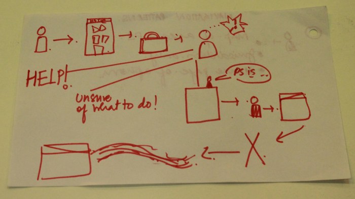
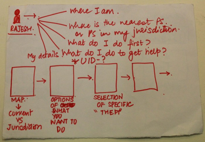
At first we looked at various options that would be feasible for a citizen and built the follow- up steps according to that. What would be available to the citizen, how would the flow of information work and what would he see and would would he do. A critical question (and rather difficult to answer) was the availability of a map and at what point.
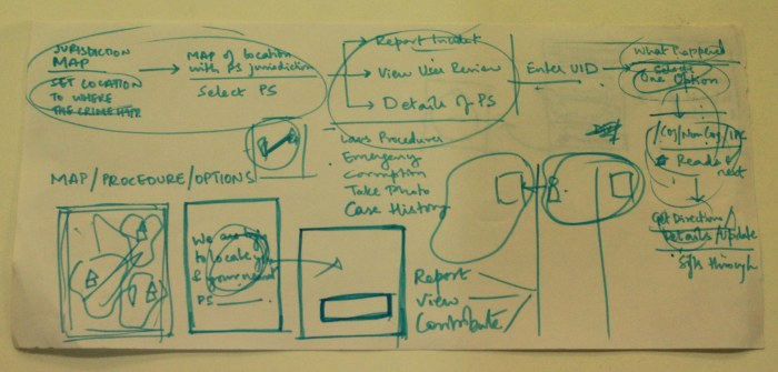
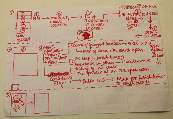
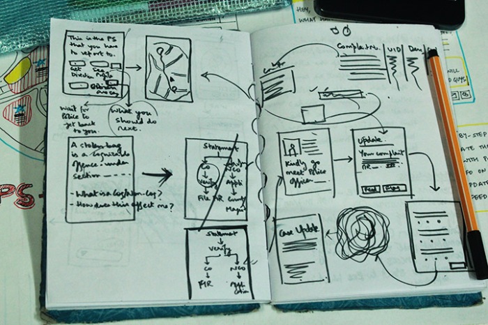
Further, we built on a decided skeleton and fleshed out more details within it. It had to be a flow which would allow him to decide swiftly what s/he needed to do next . For this, we thought it would be best if we helped her/him to decide on the homescreen whether the would be reporting something based on his current location or not. Next, what would s/he like to do (the categorisation of options under the View, Report and Contribute) and if s/he chose one of the options, how would it be built further.
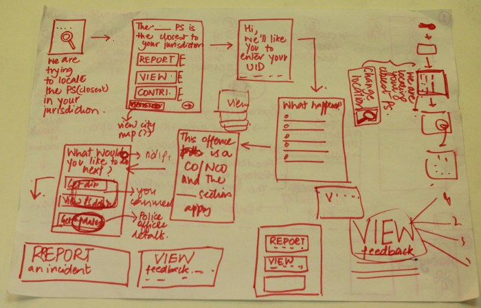
For each screen, what would be the available information, what would s/he see and what would s/he do.
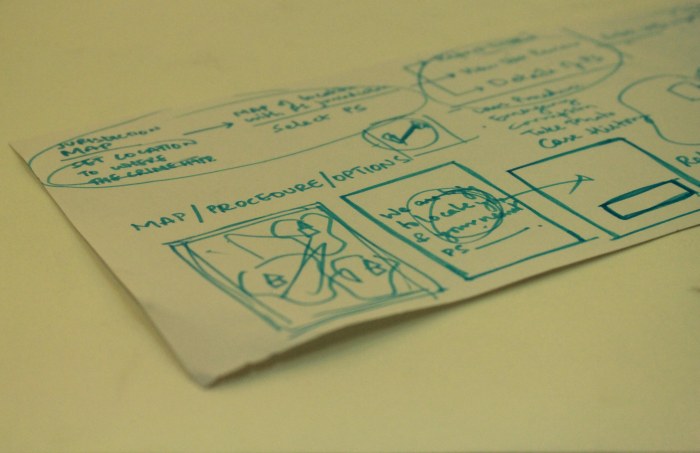
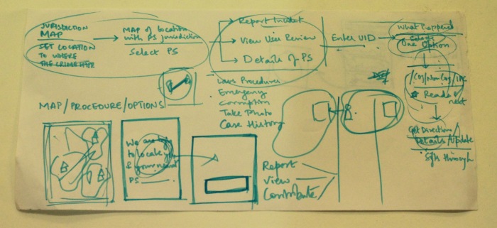
The diagram below shows part of the flow that we looked at. This highlights the initial part of the navigation.
Next, we’re looking at the User Interface of the application.
A New Name. A New Identity.
After deciding the final solution, the next step we took was to design the identity for Plus. Our keywords were the Police, the Citizen, the connection, a navigation tool, a companion, community building. Looking at various forms, abstract representations and colour representations, after building some options, we froze on one for a while.
But as we looked at it more and more, we started to question whether it made sense to the entire concept or not. Was it giving the first impression of something else? Was a connect being drawn with what we were looking to focus on? We also got some feedback and thoughts about it from some classmates and realised that it was something that may not work.

It was then decided, that we needed an update on the name of the solution. Perhaps a name that would draw a better connect to the concept.
We thought of names that could suit the solution. Some that came up were silly, funny but some made sense. We decided to name our app PoliCiti, coming from Police and Citizen, which is what the app is meant to do, connect the two better. It was critical to keep it simple and clean, because of the size of the icon on the screen of a phone would be small and not allow for any major detailing. It was also important to keep in the mind the colour of the identity, because it would have to be soothing and calming the citizen, when he looks at it and uses. The colour scheme would also define the look and feel of the interface we were looking to build next.
Introducing Jaimeen
Maps, Navigation and Companions – The Selected Solution
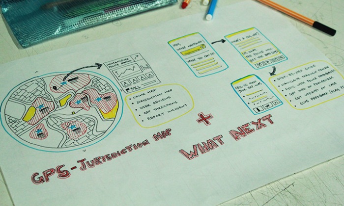 The selected solution is an integrated option that addresses four identified design opportunities. The idea is to build an application that helps the citizens navigate through the entire process of dealing with the police when an incident occurs, and give communities a way to engage with the local police by sharing experiences and flagging crime or even misdemeanor on the part of the police.
 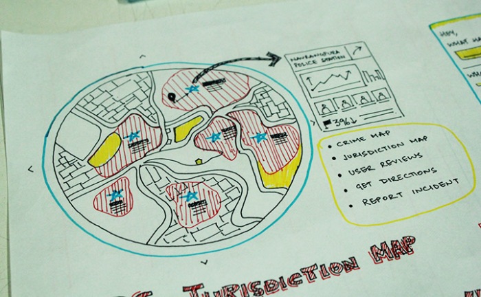 The jurisdiction maps are necessary to eliminate ambiguity of the handling of the case, and provide clear cut demarkation between police stations. This data is not available in a consolidated form even with the police department, which leads to a lot of confusion and hassle for the citizens as they are sent from one police station to another trying to get their complaints filed. The jurisdiction maps can then be overlayed with crime data of the particular area to get a sense of efficiency or misconduct. For example, if the crime rate of a particular area is extremely low but the number of complainants are high, that means that the concerned Police Station is not registering complaints and taking necessary action. This could give further insight into dealing with crime on a local level, and for people to make better decisions about their lives (which schools to send kids to, which areas to invest in, etc).
 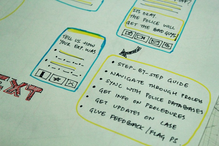 “What Next” is an extremely user friendly interface between the police and the citizens. It basically answers their “What do I do now?”, “How do I get through this?”, “Who should I go to” questions. It helps people navigate through an uncomfortable situation in a calm manner, by asking them necessary questions, providing reassurance, syncing their data to the police station systems and giving them necessary procedural and legal information as per their need at that particular time. This would help make the experience smoother and reduce the probability of the citizen being cheated or misguided at the police station due to lack of knowledge. This system would also be synced to the Investigation Officer so periodic updates can be received and the regular trips to the police station could be avoided. Further, the citizen can share his/her experience at the police station with others in the community so everyone knows who’s reliable and who’s not, and senior officers can keep a track of policing activities at the lower level.
From the policeman’s point of view, as information about the incident is directly sent from the application to the police station system, the police already know about the complainant and can assist him/her better. It also removes the need for manually filling details redundantly at various stages of the process.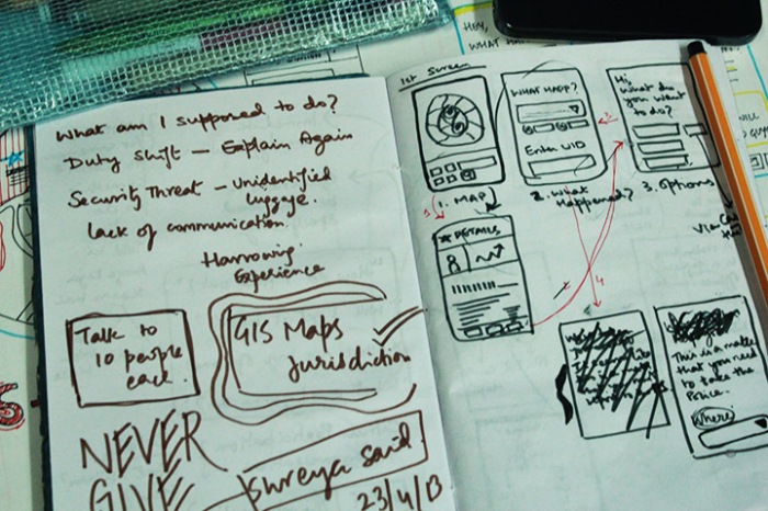
 With this concept, we hope to answer the most critical questions that people ask when they’re in a hassled situation–and make the policing system more effective and friendly, aiming to collaborate with local communities to make a crime-free society.
